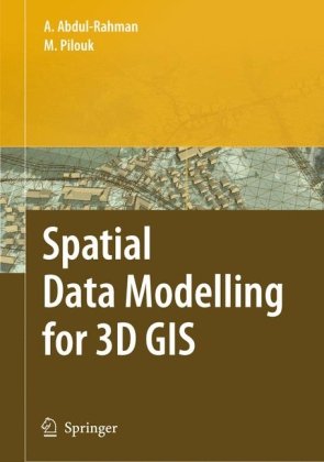
Alias Abdul-Rahman, Morakot Pilouk3540741666, 978-3-540-74166-4
Table of contents :
Preface……Page 5
Contents……Page 6
Why Does 3D GIS Matter?……Page 11
The Needs for 3D GIS……Page 13
The Need for 3D Spatial Data Modeling……Page 17
Problems Associated with Spatial Modellingfor 3D GIS……Page 19
Previous Work……Page 20
Background to the 3D GIS Problem……Page 23
GIS Functions……Page 24
3D GIS……Page 25
Recent Progress Made on 3D GIS……Page 26
ArcView 3D Analyst……Page 27
Imagine VirtualGIS……Page 28
GeoMedia Terrain……Page 29
PAMAP GIS Topographer……Page 30
Discussion……Page 32
Introduction……Page 33
Grid……Page 34
Shape Model……Page 35
Facet Model……Page 36
Boundary Representation (B-rep)……Page 38
3D Array……Page 40
Octree……Page 41
Constructive Solid Geometry (CSG)……Page 42
3D TIN (Tetrahedral network, TEN)……Page 43
GIS Applicability of the Representations……Page 45
Representation of Object Primitives……Page 46
Topology of Spatial Objects:Simplexes and Complexes……Page 48
Vector and Raster Representations……Page 49
Summary……Page 50
The Fundamentals of Geo-Spatial Modelling……Page 51
Spatial Data Modeling……Page 52
Models and Their Importance for Geoinformation……Page 53
Components of Geo-spatial Model……Page 55
Phases in Geo-spatial Modeling……Page 56
Conceptual Design of a Geo-spatial Model……Page 58
Definition of Space……Page 59
Abstraction of Space……Page 60
Abstraction of Real World Object……Page 61
Geometric Component……Page 62
Thematic Component……Page 64
Spatial Relations……Page 65
Spatial Indexing……Page 70
Spatial Analysis……Page 71
Representation of Spatial Objectsand Relationships……Page 73
Tessellation……Page 81
Tessellation by Complexes……Page 82
Tessellation by Simplices……Page 83
Single-theme……Page 84
Multi-theme……Page 85
Logical Design of Geo-spatial Model……Page 86
Relational Approach……Page 87
Smith’s Normalization……Page 88
Encapsulation……Page 89
Inheritance……Page 90
Aggregation……Page 91
Polymorphism……Page 92
Summary……Page 93
TIN-based (2.5D) Data Model……Page 94
3) Locality……Page 95
6) Compatibility with FDS……Page 96
Properties of the TIN-based Data Model……Page 97
Geometry level……Page 98
TEN-based Data Model……Page 101
Generalized n-dimensional Integrated Data Model……Page 104
The Definitions……Page 105
Single-theme and Multi-theme……Page 108
Euler’s Characteristics……Page 109
Euler’s Equality……Page 110
The Generalized Euler Equality……Page 111
Discussion……Page 114
Relational Approach……Page 116
Relational Data Structure forTIN-based Model……Page 117
Relational Data Structure for aTEN-based Model……Page 119
The Programming Language……Page 8
Object-oriented Approach……Page 123
Object-oriented Definition of aSpatial Object……Page 124
Object-oriented Design Based on IDM……Page 125
Specialization of Classes……Page 127
Aggregation of Objects……Page 132
Creation of Objects……Page 133
Behaviour of Objects in the Database……Page 135
Comparison with Other OO Approaches……Page 136
Discussion……Page 137
Object-oriented Concepts……Page 139
The Abstraction Mechanisms……Page 140
Classes for 2D TIN Tessellations……Page 142
The Classes Schema……Page 146
The POET OO DBMS……Page 152
The POET Database Schema……Page 153
POET Database Query……Page 154
Object-oriented TIN-based Subsystemsfor GIS……Page 155
Summary……Page 156
Distance Transformation……Page 158
Voronoi Tessellations……Page 163
Triangulations (TINs)……Page 168
TIN Topological Data Structuring……Page 173
Visualization……Page 175
3D Distance Transformation……Page 176
3D Voronoi Tessellation……Page 181
Tetrahedron Network (TEN) Generation……Page 186
The Line Rasterization……Page 188
The Construction of theConstrained TINs……Page 190
Data Structures for Contouring……Page 195
The Algorithm……Page 197
The Contour Visualization……Page 200
Algorithms for Irregular Network Formation……Page 201
Summary……Page 209
Integration of Terrain Relief andTerrain Features……Page 211
Creating an Integrated Database……Page 213
A Spatial Query Example……Page 216
Integrating with 3D Features……Page 218
Integrating with Geo-scientific Data……Page 223
Spatial Operators……Page 225
Graphic Visualization……Page 227
Wireframe Graphics……Page 228
Hidden Line and Surface Removal……Page 229
Surface Shading and Illumination……Page 230
Texture Mapping……Page 231
Discussion……Page 234
Introduction……Page 236
Web 3D GIS……Page 237
Management of 3D Spatial Data……Page 241
GUI for 3D Visualization and Editingon the Web……Page 243
Current and Possible Approaches inUrban Planning……Page 251
Realized Browser-based Solutions……Page 252
Stand-alone Solutions/Toolkits/Front-ends……Page 257
Summary……Page 258
Summary……Page 259
Further Research……Page 266


Reviews
There are no reviews yet.